WayFinding experience for venues

Stadium visitors, especially those attending a one-time event, often struggled to find their seats due to complex architectural layouts with multiple floors, corridors, and vomitories. The existing experience lacked guidance, creating confusion, stress, and bottlenecks.
🚫 Due to data policy with the company, detailed information on some specifications, processes or designs is not provided.
Impact
4.2
User confidence score in finding their site
-35%
Less time to move to assigned seats
-24%
Less assistance by users registered
Task
Design a user-friendly wayfinding system that enables all attendees, regardless of familiarity with the venue, to independently and safely navigate from entrance to seat. The system also needed to enhance pre-sale services and provide useful venue information throughout the journey.
Action
- Conducted UX research, benchmarking, and card sorting to understand user mental models and expectations.
- Designed wireframes centered around a map-based system, iterated through user testing:
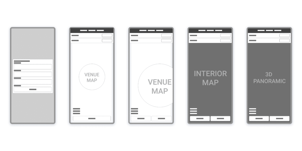
- Wireframe of the first prototype, containing the user journey from the seat finder to the 3d view of the seat.
- Developed a step-by-step navigation flow with:
- 3D visualizations of selected seats.
- Indoor and outdoor navigation maps.
- Information overlays to enhace location context for the user.
- Adapted the solution for both desktop and app platforms to ensure accessibility.
Result
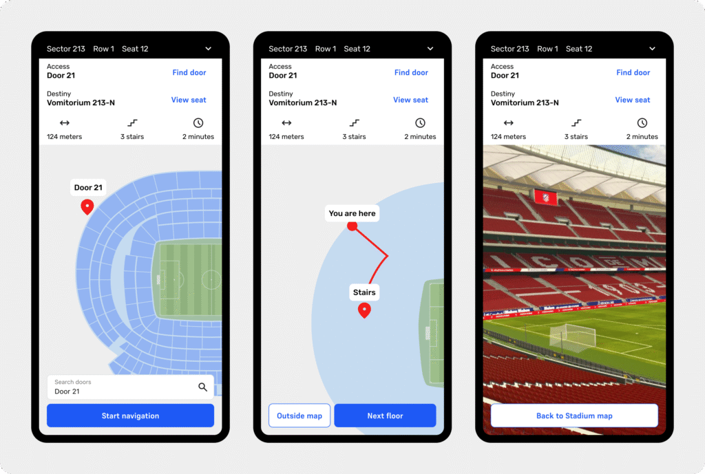
Wi-fi screens with iterations. From left to right: inside map navigation view, 3D view of the chosen seat, and outside map view.
- Delivered a working prototype of a product, wich is capable of guiding users through a stadium of over 80,000 seats, from optimal entry point to final seat.
- Improved user autonomy and reduced the reliance on staff assistance for venue users.
- Interface iterations based on jobs-to-be-done analysis addressed diverse user cohorts, incorporating detailed wayfinding data for better decision-making.
Further testing
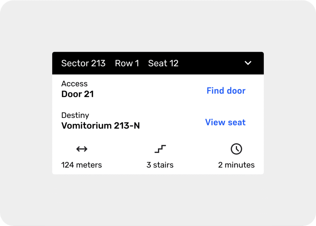
Later in an analysis of the jobs to be done, iterations were made to improve the interface and allow the user to have more information needed on their journey (time, distance, stairs), taking into account different cohorts of users.